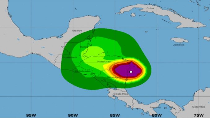
This has been a record breaking year for hurricanes and tropical storms and we sure hope this is the last one of the year. Our thoughts are with all in the path …
This is what we know …
According to the National Hurricane Center, the hurricane made landfall south of Puerto Cabezas (also hit in 2007 by Hurricane Felix) with sustained winds at 140 mph. This is a slow moving storm and traveling at about 5 mph.
Hurricane Eta is expected to produce the following:
- Rainfall of 15-25 inches for much of Nicaragua and Honduras (some areas may see 35 inches)
- Eastern Guatemala and Belize will likely see 10 to 20 inches (some areas may see 25 inches)
- Some areas in Costa Rica and Panama may see 10-15 inches with about 25 inches in some isolated areas
- Southeast Mexico and El Salvador – looking at 5-10 inches with possible flash flooding and river flooding
- Jamaica, Southern Haiti and the Cayman Islands – it’s looking like 3-5 inches with possible flash flooding and river flooding
It’s projected that this heavy rainfall could lead to life-threatening flash flooding and river flooding with a concern of landslides in Central America in areas with higher terrains.
As far as storm surge – Hurricane Eta could raise water levels by as much as 14 – 21 feet above normal tide levels.
Surf swells are expected in portions of Central America along the coastline and the Yucatan Peninsula in Mexico over the next few days. These swells could cause life-threatening surf and rip currents.
It’s possible that Hurricane Eta will go across Cuba later this week and then toward south Florida over the weekend.
Stay tuned for more details with the National Hurricane Center.
Don’t Miss:
Avoid Hurricanes – Try Curacao
Travel During Hurricane Season: The Pros and Cons


