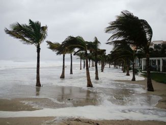
Bookmark this Page, as we’ll do our best to keep it current with the most recent news and updates on Hurricanes and their impact, and be sure to also check the NOAA’s National Hurricane Center website as well, as our focus will be mainly on the Caribbean and the impact of Caribbean hurricanes on the all-inclusive resorts in that region.
You’ll find the most current hurricane update info near the top and by scrolling down you can read older information (if you’re a hurricane junkie, LOL).

2024 Hurricane Updates
Hurricane Milton
10/08/24 – Like Hurricane Helene, Milton formed in the Gulf of Mexico and is currently dropping intense rain and high winds in excess of 100mph with gusts up to 125mph. Hurricane Milton is moving northeasterly towards the Tampa area of Florida, where it’s anticipated to make landfall by early Wednesday morning, at which point forecasters are predicting wind gusts of roughly 145mph. Unlike prior hurricanes, Milton grew from Tropical Storm status to Category 5 status in a record-shattering single day, but has since been downgraded to Category 4 early this morning. Hurricane Milton is expected to be the strongest of 2024, and second only to 1980’s Hurricane Allen.
Hurricane Helene
10/05/24 – Although Hurricane Helene formed just off the Yucatan Peninsula in Mexico, it caused little impact (beyond some mild wind and rain) to the popular tourist destinations in eastern Mexico and the Caribbean islands, as it moved northeast where it did major damage to multiple U.S. states, causing major flooding, severe damage, and a death toll that is still climbing.
Hurricane Beryl
07/10/24 – Although downgraded substantially, Beryl is still causing dangerous weather across the U.S., and nearly 1.7 million residents remain without power in Texas. The low pressure left in Beryl’s wake is reaching as far north as the eastern Great Lakes en route to Canada, and dumping heavy rainfall in parts of the northeastern United States today, while increasing the risk of tornadoes.
Flood watches will be in effect in New England through Thursday morning, where torrential downpours are expected. To the south — between Pennsylvania and central New York — more scattered thunderstorms are possible; any of which could produce tornadoes.
07/08/24 – Hurricane Beryl made landfall in Texas a bit before 4am this morning as a Category 1 Hurricane, then left as a Tropical Storm roughly 5 hours later, leaving behind heavy rains and flooding along with powerful winds that knocked out power to 1.5 million homes and businesses as first responders worked to rescue stranded residents. At least two people were killed. The National Hurricane Center said damaging winds and flash flooding will continue as Beryl continues pushing inland.
07/05/24 – Hurricane Beryl made shore on Mexico’s Yucatan Peninsula as a Category 2 Hurricane, causing mostly heavy rainfall and high winds, with some power outages reported but no deaths. Beryl slowed to a Tropical Storm before passing over into the Gulf of Mexico, where the very warm waters of the Gulf are expected to cause the storm to regain Hurricane status before it reaches southern Texas by Sunday night or Monday morning.
National Hurricane Center senior specialist Jack Beven said Beryl is “likely to make landfall somewhere between Brownsville and a bit north of Corpus Christi Monday. The hurricane center forecasts it will hit as a strong Category 1 storm“, but wrote “this could be conservative if Beryl stays over water longer” than expected. “We should not be surprised if this is rapidly intensifying before landfall and it could become a major hurricane,” said Weather Underground co-founder Jeff Masters, a former government hurricane meteorologist who flew into storms. “Category 2 may be more likely but we should not dismiss a Category 3 possibility.”
07/04/2024 – Officials estimate that Hurricane Beryl has claimed at least nine lives so far as it brushed past Jamaica and the Cayman Islands. As of mid-day Eastern Time Thursday (today), Hurricane Beryl was west-southwest of Grand Cayman and heading west-northwest at 18 mph towards Mexico’s Yucatan Peninsula (and the tourist destination of Cancun and the Riviera Maya), where it is expected to make landfall sometime tonight and into tomorrow morning. Beryl’s maximum sustained winds were estimated to be 115 mph, making it a Category 3 hurricane, down from a Category 4 on Wednesday and a Category 5 as recently as Tuesday morning, but it’s expected to weaken further before hitting Mexico.
07/03/2024 – Hurricane Beryl wreaked havoc along the southern coast of Jamaica on Wednesday, bringing extreme winds and heavy rainfall that has knocked down trees and caused power outages at various place on the island nation. Jamaican Prime Minister Andrew Holness said on Wednesday afternoon that nearly 500 people were placed in shelters, but that they have not yet seen the worst of it. The Prime Minister of St. Vincent and the Grenadines, located in the Windward Islands chain, said his country has experienced “immense destruction” and that 90% of the homes on Union Island, a small community of 3,000 people, have been “severely damaged or destroyed.” The roof of the airport was ripped away, telephone lines are down, and hospitals have been damaged, along with several businesses.
07/02/2024 – Late this morning, Hurricane Beryl was located roughly 235 miles (375 kilometers) southeast of the Dominican Republic, was moving west-northwest at 22 mph (35 kph), and had top winds of 160 mph (260 kph). In Miami, National Hurricane Center Director Michael Brennan said Jamaica appears to be in the direct path of Beryl, where the expectation is for a storm surge of 5-8 feet above typical tide levels, as well as heavy rainfall. If the storm’s path stays on its present course, it should also make landfall along much of the eastern coast of Mexico, including the Yucatan Peninsula (Cancun/Riviera Maya) and also the south-eastern tip of Texas south of Houston.
07/01/2024 – Hurricane Beryl, shattering all records for this time of year, made landfall early this morning on Grenada’s Carriacou Island, as weather experts called it an “extremely dangerous” Category 4 hurricane, with winds that had increased to 150 mph. Though there were no immediate reports of deaths or injuries, Grenadian Prime Minister Dickon Mitchell warned: “That may change quickly. … In half an hour, Carriacou was flattened.” It surpassed Hurricane Dennis (2005) as the strongest Atlantic hurricane to form so early in a year.
The weather gurus at the NHC say it’s still too early to predict where Beryl will head next after the Lesser Antilles, but Jamaica, Cuba and Mexico’s Yucatán Peninsula in particular are at risk. The odds of Beryl entering the Gulf of Mexico as a hurricane are currently low – but not zero – though that possibility could change by the weekend. The risk to the United States – at the moment – is very low.
06/30/2024 – Hurricane Beryl grew rapidly overnight, going from a tropical storm with 60-mph winds to full Category 4 status today, with maximum sustained winds of 130 mph today. The storm rate of growth in intensity is considered by experts to be unprecedented for June, and it’s en route to the Lesser Antilles, an island chain on the eastern side of the Caribbean Sea. The National Hurricane Center is warning of “life-threatening” impact. Hurricane warnings have been issued for Barbados, St. Lucia, St. Vincent and the Grenadine Islands, Grenada and Tobago, while a tropical storm warning covers Martinique.
St. Lucian Prime Minister Philip J. Pierre said on Facebook that emergency services officials declared a national shutdown for the country of about 170,000 people starting at 8:30 p.m. Sunday.
2023 and Older Hurricane Updates Below
Hurricane Storm Lee – September 2023
09/07/23 – Hurricane Lee has been rapidly intensifying in the eastern Atlantic and is now predicted to reach Category 5 strength, the National Hurricane Center said in the latest advisory. Lee’s top wind speeds are now predicted to reach 160 mph, just above the minimum threshold for a Category 5 hurricane at 157 mph, up from 155 mph earlier Thursday morning, according to the NHC. Current models “are calling for remarkable rates of intensification, beyond rates normally seen with model forecasts“, and swells generated by Lee are expected to reach portions of the Lesser Antilles on Friday, moving on to the Virgin Islands, Puerto Rico, Haiti, the Dominican Republic, Bahamas and Bermuda this weekend…and could be potentially “life threatening”.
09/06/23 – Tropical Storm Lee formed Tuesday in the central Atlantic Ocean and forecasters expect Lee to become a Category 4 hurricane as it approaches the Caribbean by the weekend. Located some 1,230 miles (1,980) kilometers east of the Lesser Antilles Tuesday night, Tropical Storm Lee had maximum sustained winds of 50 mph (85 kph) which strengthened rapidly overnight to 65 mph early Wednesday, and was moving west-northwest at 16 mph (26 kph). According to the National Hurricane Center in Miami, Lee is forecast to strengthen into an “extremely dangerous” hurricane by Friday as it moves over record-warm waters and pass just northeast of the Caribbean region. Although not predicted to make any landfall, the NHC warned that “it is too early to determine exactly how close this system will be to the Leeward Islands.” Forecasters also said it could reach the mainland United States next week, hitting anywhere on the East Coast between Florida and Maine.
Tropical Storm Franklin – August 2023
08/23/23 – Tropical Storm Franklin made landfall early this morning (Wednesday) on the island of Hispaniola, which is shared by the countries of the Dominican Republic and Haiti, and dumped heavy rains that are expected to bring flooding and possible landslides in both countries.
Forecasters said that Franklin was expected to hover over the island for most of the day, and warned that the storm could drop up to 12 inches (30 centimeters) of rain in the Dominican Republic, with a maximum of 16 inches (41 centimeters) for the country’s western and central regions. Meanwhile, up to 4 inches (10 centimeters) of rain are forecast for Haiti, with nearly 8 inches (20 centimeters) for the country’s eastern regions.
08/21/23 – Tropical Storm Franklin formed early Sunday in the Caribbean, and after dropping heavy rain over parts of Puerto Rico early on Monday, is currently located some 240 miles (390 kilometers) south of Santo Domingo, the capital of the Dominican Republic. Both Haiti and the Dominican Republic are warning residents to prepare for floods and landslides, as the storm has maximum sustained winds of 50 mph (85 kph) and is moving west at 6 mph (9 kph), and is forecast to make a sharp turn north late Monday or early Tuesday. Franklin is expected to strengthen before making landfall late Tuesday in Hispaniola, the island shared by Haiti and the Dominican Republic. The storm is forecast to drop up to 10 inches (25 centimeters) of rain.
Meanwhile, Gert formed overnight to become the eighth named storm of the Atlantic hurricane season. It formed some three weeks early compared with the dates of the eighth named storms from 1991 to 2020, said Brian McNoldy, senior research associated at University of Miami. We’ll be keeping a close eye on Gert!
Huricane Hilary – August 2023
08/19/23 – After rapidly gaining power early Friday, Huricane Hilary slowed some later in the day but remained a major Category 3 hurricane early Saturday with maximum sustained winds of 125 mph (205 kph), down from 145 mph (230 kph), and is headed for Mexico’s Baja California today as the U.S. National Hurricane Center predicts “catastrophic and life-threatening flooding”. Hilary is expected to plow into Mexico’s Baja peninsula on Saturday night and then surge northward and enter the history books as the first tropical storm to hit Southern California in 84 years.
08/18/23 – It’s been a quiet Hurricane Season so far, but appears to be ramping up…A tropical storm in the Pacific strengthened into Hurricane Hilary on Thursday, causing the western coast of Mexico to suffer torrential rains and some areas of flash flooding. Meterologists reported that maximum sustained winds reaching 140 miles per hour early Friday, making it a powerful Category 4 storm faster than expected. Forecasters urged people on Mexico’s Baja California peninsula and in the southwestern United States to monitor the storm closely. Hilary is expected to continue strengthening early Friday as it approaches Baja California before weakening some on Saturday.
Hurricane Adrian (Pacific Ocean) – June 2023
06/29/23 – Hurricane Adrian gained strength Thursday far off Mexico’s Pacific coast, but father south and closer to land, a new tropical depression has formed that has forecasters much more worried (more on that as it develops). Regarding Hurricane Adrian though, the U.S. National Hurricane Center reported sustained winds of 85 mph (140 kph).
On Thursday morning, the hurricane’s center was about 440 miles (710 kilometers) west-southwest of the Pacific coast seaport of Manzanillo, Mexico. The hurricane center said Adrian was moving west-northwest at about 8 mph (13 kph), and that general motion was expected to continue, however Hurricane Adrian is expected to weaken again to a tropical storm by the weekend and keep heading out to sea.
Tropical Storm Cindy – June 2023
06/22/23 – Tropical Storm Cindy is growing and following behind Tropical Storm Bret, in what forecasters said is the first case of two storms in the tropical Atlantic in June since record keeping began in 1851.
Some forecasters are blaming the unusually high sea temperatures for the rare occurrence and calling it “an early and aggressive start to the Atlantic hurricane season”, which officially began on June 1. Hurricane Season usually peaks from mid-August to mid-October and generally ends in late November.
“The Atlantic is awfully warm this year,” said Kerry Emanuel, a meteorologist at the Massachusetts Institute of Technology, adding that it’s partly a result of global warming, natural variability and the ocean’s recovering from sulfate aerosols pollution that cooled it decades ago.
Tropical Storm Bret – June 2023
Update: 06/20/23 – According to this morning’s report from the NHC there has been no substantial change overnight in either the strength or direction of Tropical Storm Bret, the forecast remains the same.
Update: 06/19/23 – Tropical Storm Bret formed in the central Atlantic Ocean on June 18th, 2023, with forecasters saying it could pose a hurricane threat to the eastern Caribbean by Thursday the 22nd and then to the Dominican Republic and Haiti by the weekend.
The National Hurricane Center in Miami said Bret had maximum sustained winds of 40 mph (65 kph) at 5 p.m. Monday as it moved west across the Atlantic at 21 mph (33 kph). Forecasters expect it to strengthen to a Category 1 hurricane with winds up to 74 mph (120 kph) but is not expected to strengthen into a Category 2 storm.
As Bret moves across the Lesser Antilles on Thursday and Friday it is likely to unleash flooding, heavy rainfall and dangerous storm surge and waves, according to the NHC. It is then expected to weaken slowly while still in the eastern Caribbean region, although the center warned that its forecast “remains a low confidence prediction” as “there continues to be larger than usual uncertainty,” of the storm’s forecasted path.
Tropical Storm Arlene – June 2023
The first named storm of the Atlantic hurricane season, formed at the beginning of June in the Gulf of Mexico and headed immediately south toward the western tip of Cuba. While Arlene had sustained winds of 40 mph (65 kph) there were no storm watches or warnings posted for Cuba or Florida as the storm never got any stronger and had little impact on the region.
2022 and Older Hurricane Updates Below
Tropical Storm Nicole – November 2022
Update: 11/10/22 – After lashing the Bahamas as a Category 1 Hurricane and causing widespread flooding, Nicole meandered up to Florida, making landfall on its eastern coast at 03:00 EST (08:00 GMT) with winds of up to 75mph (120km/h). The winds have weakened slightly to around 60mph currently, and Nicole has been downgraded to a tropical storm as it makes its way north-west across the sunshine state. Approximately 215,000 homes and businesses in Florida have been left without power, and states of emergency and evacuation orders are in place. Residents have been told to stay indoors with heavy rain and storm surges forecast (Per the BBC news).
11/09/22 – Nicole was upgraded to “Tropical Storm” status late yesterday and just prior to noon EST on Wednesday (today), Nicole made landfall on Great Abaco Island, Bahamas, packing sustained winds of 70 mph. Moving toward the west at 12mph, Nicole is expected to continue to strengthen into a Category 1 Hurricane Wednesday afternoon or evening, and should make landfall along Florida’s east coast, likely in the Stuart, Port St. Lucie and Fort Pierce area of Florida, during the middle of Wednesday night or very early Thursday morning.
11/08/22 – Sub-Tropical Storm Nicole could achieve Category 1 Hurricane strength late tomorrow (Wednesday), according to National Hurricane Center forecasters. Nicole was hundreds of miles east of the northwestern Bahamas, with top sustained winds of 45 miles per hour early this morning. “On the forecast track, the center of Nicole will approach the northwestern Bahamas on Tuesday, move near or over those islands on Wednesday, and approach the east coast of Florida by Wednesday night,” said NHC.
11/07/22 – According to the Orlando Sentinel, while Nicole is presently classified as subtropical with a massive wind field with 40 mph winds out as far as 275 miles, the forecast predicts it will transition to a tropical system and is expected to become a hurricane while over the Bahamas on Wednesday night on its way to Florida with 75 mph winds and gusts up to 90 mph.
Hurricane & Storm Surge Watches have been issued for the east coast of Florida, and the Tropical Storm Watch has been changed to a Hurricane Watch for the NW Bahamas.
Per the NHC, “Regardless on the ultimate intensity of Nicole, the storm’s large size due to an enhanced pressure gradient north of the storm will likely cause significant wind, storm surge, and rainfall impacts over a large portion of the northwestern Bahamas, Florida and the southeastern coast of the United States during much of the upcoming week.”
Hurricane Roslyn – October 2022
Updated 10/24/2022 – Reuters reports that two people died Sunday after Hurricane Roslyn made landfall on Mexico’s Pacific coast as a Category 3 hurricane with top sustained winds of 120 miles per hour. A 74-year-old man was killed by a falling beam in Mexcaltitan de Santiago Ixcuintla, and a 39-year-old woman died when a fence collapsed on her in the state’s Rosamorada district. Hurricane Roslyn’s strong winds and torrential rains flooded streets and damaged homes. Roslyn weakened quickly and was downgraded to tropical storm status as it pushed inland, but heavy rains continue to pose a flood threat until finally dissipating earlier today.
10/23/2022 – Hurricane season isn’t over yet! Today western Mexico is preparing for Hurricane Roslyn to batter the country’s Pacific coast. The storm is likely to make landfall as a major Category 3 hurricane, with sustained winds of up to 120 mph according tothe National Hurricane Center. Torrential rains and dangerous storm surges are expected early Sunday, but Hurricane Roslyn is likely to weaken by mid-afternoon as it begins pushing inland. Meteorologists are predicting that there were still be significant amounts of flooding along most Pacific coastal regions.
Tropical Storm Karl – October 2022
10/12/2022 – A large storm brewing in the southwestern Gulf of Mexico, now officially named Tropical Storm Karl, has been strengthening as of early this morning. However, the National Hurricane Center (NHC) expects it to be weaker by tomorrow (Thursday) according to The Orlando Sentinel. AccuWeather says that Karl was first detected in the Bay of Campeche yesterday (Tuesday), roughly 185 miles north-northeast of Veracruz, Mexico, with maximum sustained winds at 45mph. The storm was moving at 6 mph, and its tropical-storm-force winds extended 105 miles from the center of the storm.
Hurricane Orlene – October 2022
10/03/2022 – Hurricane Orlene, the 9th storm of the 2022 hurricane season to occur in the eastern Pacific, arrived on Mexico’s western coast Monday near the resort town of Mazatlan with winds at approximately 85mph. Orlene had developed quickly, becoming a powerful Category 4 hurricane with maximum winds of 130 mph, but she had weakened while approaching land, losing strength rapidly after making landfall and moving inland, mainly dumping a ton of rain. Hurricane Orlene’s heavy rains could trigger flash floods and landslides, the National Hurricane Center warned.
Hurricane Ian – September 2022
Update: 10/01/2022 – Hurricane Ian blasted into South Carolina on Friday afternoon, leaving a wake of damage and flooding across the state just days after the storm devastated Florida, where early estimates are that Ian left at least 67 people dead. Even after weakening to a Category 1 storm by the time it reached South Carolina, Hurricane Ian still dumped heavy rains across the eastern seaboard. Now downgraded to what is called an “extratropical low-pressure system” (meaning that it is no longer being affected by warm ocean waters), remnants of the storm will continue to bring rain and potentially flooding, while more than 60,000 South Carolinians are reportedly without power.
09/30/22 – Having been demoted briefly to Tropical Storm status as it crossed Florida on its way back out to sea, Ian has gained strength over the Atlantic and is now back to full-on Hurricane level as it heads for South Carolina, where Hurricane Ian is expected to make landfall as a Category 1 storm.
09/29/22 – Hurricane Ian has officially tied with 2004’s Hurricane Charley as the strongest storm to hit Florida’s gulf coast. Ian made landfall near Cayo Costa and as it crossed the state toward Orlando it caused more damage and left roughly two million Floridians without power. Hurricane Ian also destroyed the Pine Island Bridge as well as several portions of the Sanibel Causeway that connects both Sanibel Island and Captiva Island to the mainland. As of early this morning, Ian has been downgraded to tropical storm status with top winds of 65 mph, and is heading northeast across central Florida leaving catastrophic flooding and leveled buildings in its wake. Ian is now expected to emerge over Atlantic waters Thursday and move north toward a possible second U.S. landfall.
09/28/22 – After leaving the entire island of Cuba without power, Hurricane Ian is now officially at Category 4 status, with sustained winds averaging 140mph, and barreling towards the Gulf coast of Florida. Evacuations around the Tampa Bay area continue and a potentially deadly storm surge is expected.
09/27/22 – Hurricane Ian, having strengthened to Category 3 status, has blasted Cuba with top sustained winds of ~125mph, and should make landfall on western Florida – possibly at Category 4 level – sometime early on Wednesday. Officials in low-lying Tampa Bay have been issuing evacuation orders as major flooding is expected as they brace for the worst storm they’ve seen in roughly a century.
09/25/2022 – Tropical Storm Ian has been doing little more than dropping heavy rains and wind throughout the Caribbean but is predicted to achieve “hurricane” status with a major increase in intensity sometime late Sunday or early Monday as it crosses Grand Cayman and parts of Cuba, before it makes landfall in Florida midweek, likely Wednesday. Currently it’s path suggests it will hit the western coast of Florida, where a state of emergency has already been proactively declared. We’ll be watching this one closely!
Hurricane Fiona – September 2022
Update: 09/26/2022 – Ian officially made ‘hurricane’ status early this morning as it approaches the western shore of Cuba. With current sustained winds at 75mph, it’s expected to make landfall late today or in the early hours of Tuesday, and is expected to continue gathering strength over the Gulf of Mexico before hitting the western coast of Florida as early as Wednesday.
09/24/2022 – Hurricane Fiona, which as it moved north became known as a ‘cyclone’, ravaged the eastern coast of Canada on Saturday, leaving behind collapsed homes, washed-out roads, and downed power lines that left nearly a half-million Canadians without power, before it weakened and headed out into the Atlantic.
09/23/2022 – The center of Hurricane Fiona has passed just west of Bermuda and she’s currently heading north-northeast in the Atlantic, with winds reaching 130 miles per hour. Fiona is expected to approach Nova Scotia, on the eastern coast of Canada, later today. The Canadian Hurricane Center issued warnings for “what looks to be a historic storm for eastern Canada.”
09/22/2022 – According to CNN, on Wednesday, Hurricane Fiona strengthened to a Category 4. With a reported 130 mile-per-hour winds and gusts reaching 155 miles per hour, Fiona left behind a trail of destruction in Puerto Rico, the Dominican Republic, and Turks and Caicos, causing at least 5 deaths across the Caribbean, extreme flooding and mudslides, as well as wide-spread power outages and damage to various islands’ fresh water infrastructure which leaves them severely short of clean drinking water.
Fiona arrives almost exactly five years after Hurricane Maria, which caused devastating damage in Puerto Rico. Approximately 1.1 million people are without power — nearly one-third of the population of the U.S. territory. The Federal Emergency Management Agency (FEMA) is assisting in Puerto Rico after President Biden issued a state of emergency on Sunday.
A tropical storm warning and hurricane watch has been issued for Bermuda, where Fiona is likely to land towards the end of the week. The U.S. State Department issued a travel advisory stating, “U.S. citizens in Bermuda wishing to depart the island should depart now, ahead of Hurricane Fiona’s arrival.”
Hurricane Eta – November 2020
According to NOAA, Hurricane Eta made landfall south of Puerto Cabezas (also hit in 2007 by Hurricane Felix) with sustained winds at 140 mph. This is a slow moving storm and traveling at about 5 mph.
Hardest hit were Nicaragua and Honduras as well as Eastern Guatemala and Belize, lesser damage was seen in some areas of Costa Rica and Panama. For the most part southeastern Mexico and El Salvador saw mostly heavy rain and some flooding. Jamaica, Southern Haiti and the Cayman Islands experienced lesser rain and flooding.
Hurricane Delta – October 2020
Hurricane Delta made landfall as a Category 4 and the northeastern coast of the Yucatan Peninsula saw life-threatening winds and storm surge along with heavy rain.
According to Accuweather.com, Delta became the 25th tropical storm in 2020 and the first major hurricane to occur in October since 2018’s Hurricane Michael. Hurricane Delta is also the most extreme in the last 15-years for an October hurricane.
Western Cuba and portions of the Cayman Islands were also affected as Hurricane Delta brought them 2 to 4 inches of rain, causing some flash floods and mudslides.
Hurricane Laura – August 2020
Tropical Storm Marco quieted to a tropical depression while Hurricane Laura gained strength over the warm waters of the Gulf and the Caribbean was battered by both Tropical Storms as Marco weakened and Laura strengthened. Tourists in Mexico’s Quintana Roo made it through the storms, which also spared its all-inclusive resorts and beaches.
Laura also brought heavy rain and high winds to Puerto Rico causing evacuations due to potential flooding and mudslides. The Dominican Republic and Haiti were also on high alert, especially after recent Hurricane Isaias passed through affecting the area. Tropical Storm Laura brought rain, wind, and disrupted power as she swept through the area.
Hurricane Maria – August 2017
In 2017 Hurricane Maria wreaked havoc on Puerto Rico and much of the Caribbean, and the U.S. Territory of Puerto Rico was just re-opening to tourism in 2022 when they were struck again by Fiona (see above).
Hurricane Maria left many Caribbean islands without power for many months, in the case of Puerto Rico, for years. Heavy rains, flooding, mudslides, and damage to the islands’ fresh water infrastructure also left much of the Caribbean without safe drinking water.
Hurricane Lane – August 2018 (Pacific)
While there are no all-inclusive resorts in Hawaii, we’re including this here for you hurricane junkies as it’s interesting that Lane was the first storm to threaten the Hawaiian Islands in over 26-years.
Hurricane Lane began as a Category 5 with winds over 150 miles per hour and landed as a Tropical Storm with winds at about 40 miles per hour and dumping over 4-feet of rain on Hawaii, with much of the damage on the Big Island. This historic rainfall was the 3rd highest at 50-inches compared to 52-inches during Hurricane Hiki in 1950 and the most recorded rainfall of 62-inches in 2017 with Hurricane Harvey in Texas.
Even though Lane was downgraded, it still caused major damage with flooding, property damage, washed out roadways in Hawaii and the winds also stirred up brush fires in dryer areas of Oahu and Maui.